River Projects
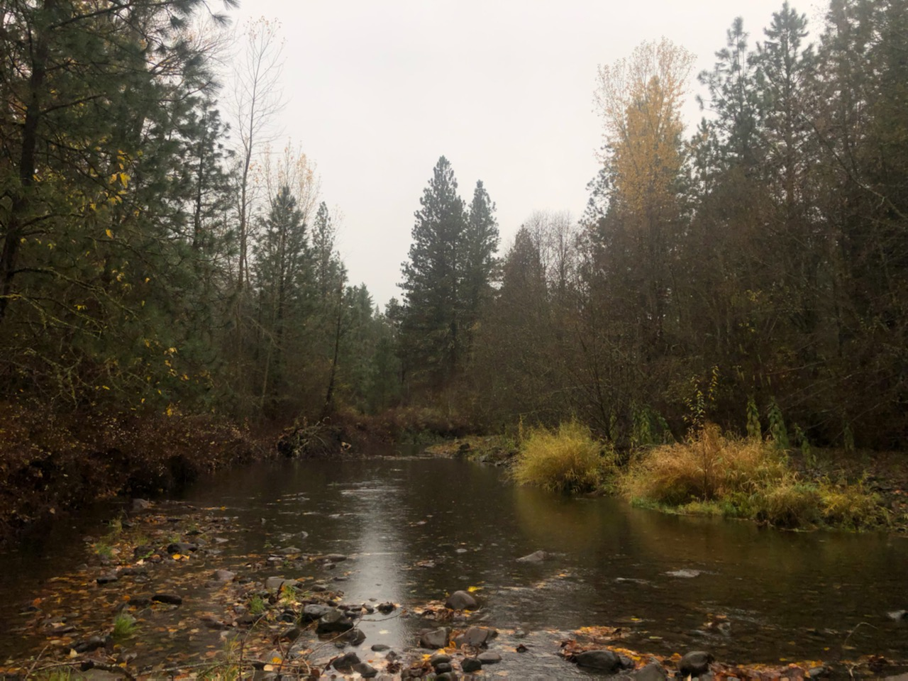
The Columbia Conservation has been engaging with landowners in the area to increase the health and resilience of river systems in Columbia County. From large rivers that are home to numerous fish species to small ephemeral streams, the district has a goal of increasing floodplain complexity, increasing biodiversity, recharging the water table, and creating new areas of robust habitat.
Historically, rivers were seen as a nuisance and liability to agricultural producers. Rivers would be diverted from their natural channels, pushed to the edge of the property, and straightened. Although this practice had some short-term advantages to famers, channelizing rivers adversely affected many natural processes and local flora and fauna.
Some of the benefits of increasing floodplain complexity:
- Natural flood control- Water in streams that have been channelized move quickly across the landscape. As the water moves faster it becomes more erosive which causes the stream to incise itself. A stream with high floodplain complexity allows the water to “bounce” around reducing its speed and thus its erosive potential.
- As water slows down in the stream it is able to permeate into the subsurface which helps recharge the water table. The area surrounding streams acts as a large sponge, storing and holding water until it is re-released during periods of drought.
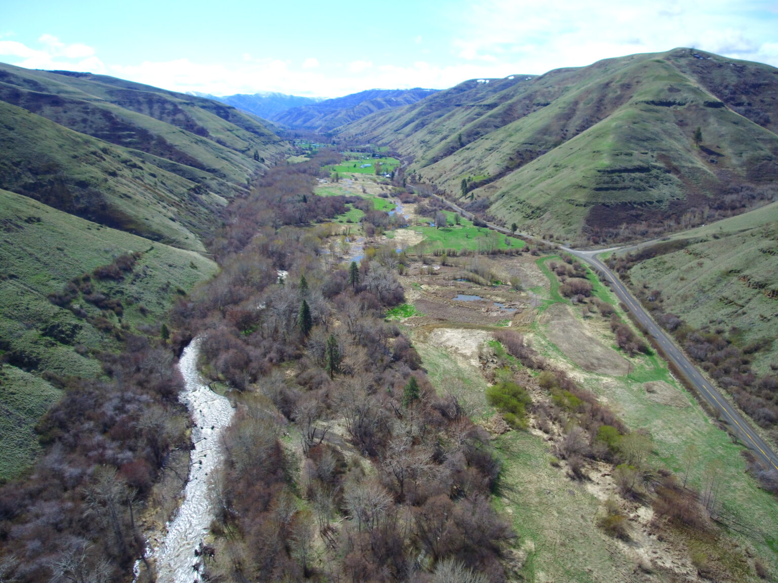
- Increasing floodplain complexity in turn creates spawning areas and habitat for a variety of aquatic species. Smaller side channels allow newly hatched fish to grow and develop in a relatively safe environment. Interconnected floodplains also contain substrates and cobbles required by salmon and other species for spawning, which are often washed away in channelized streams.
- complex floodplains can often times lead to an increase in biodiversity in the localized area. These areas provide diverse habitats that support a wide array of plant and animal species.


How does the Columbia Conservation District go about increasing floodplain complexity?
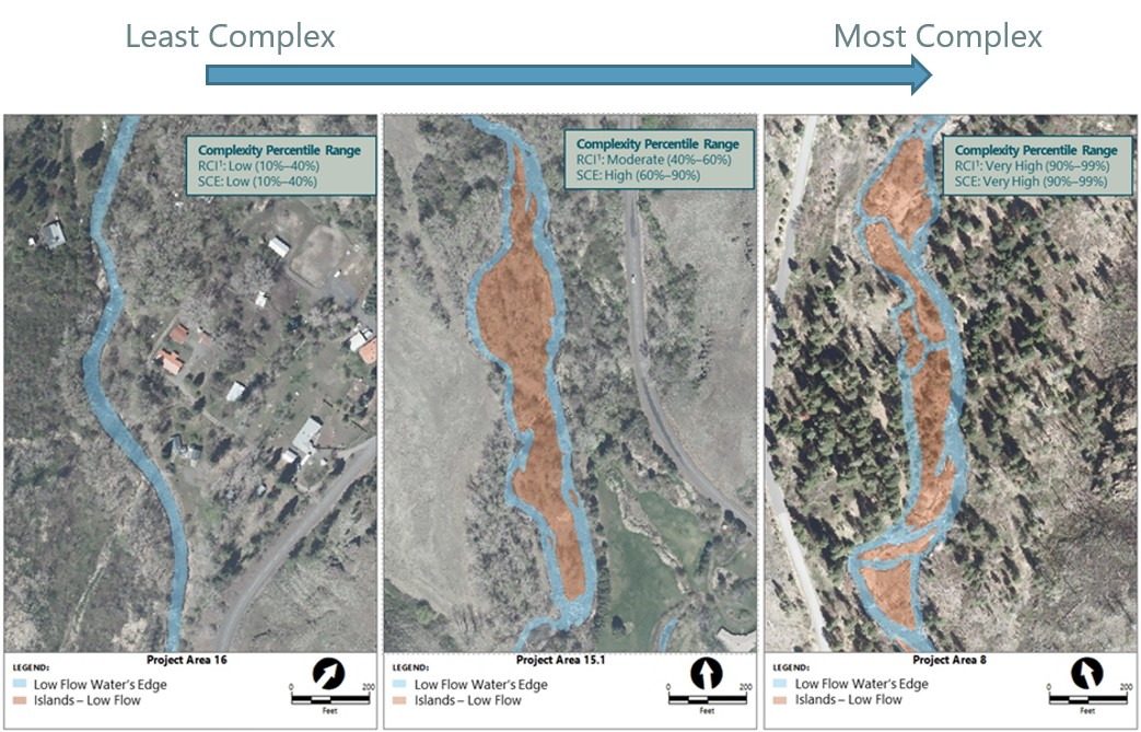
- Good data leads to good decisions. Using high resolution LiDAR images allows district staff to determine areas that are good candidates to zero our efforts in on. Being able to identify precise topological relief allows us to identify high impact areas, where smaller amounts of effort leads to more efficient results.
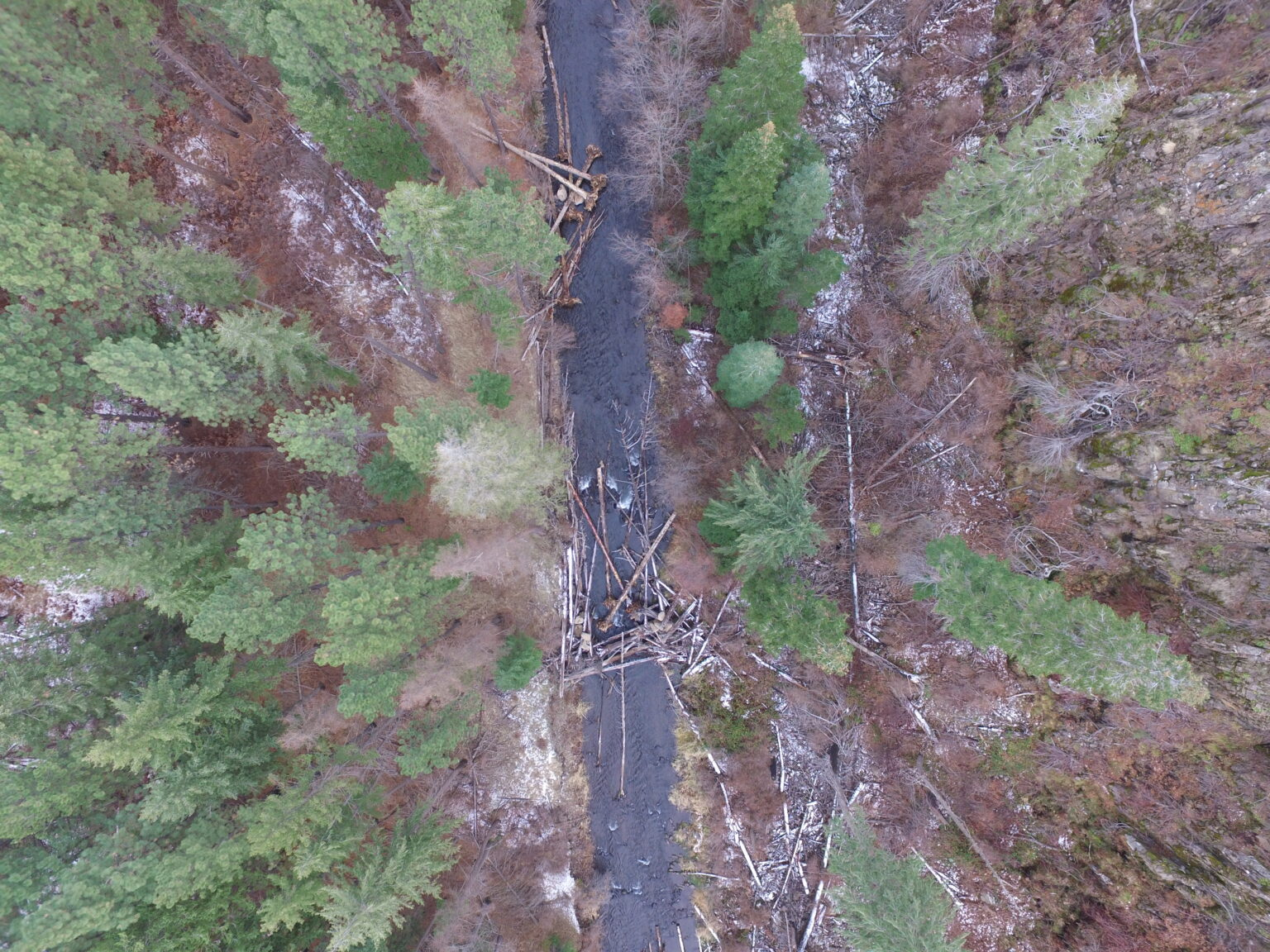
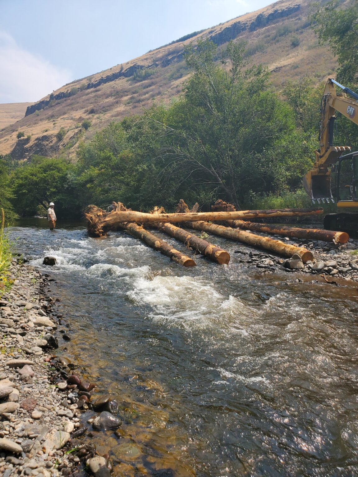
- Beaver dam analogues (BDA’s)- Beavers are one of natures most accomplished environmental engineers because their survival relies on having pools of deep water to protect them from predators. Beavers instinctively create dams of sticks, mud, and grass to create deep pools. These dams slow the water down and allow it to spread laterally across the flood plain, dramatically increasing floodplain complexity and the associated benefits. The Columbia Conservation District uses small structures called BDA’s to emulate natural beaver dams with the goal of recreating deep pools of slow moving water.
- Live plantings help prevent erosion and improve habitat in floodplains. Increasing the amount of vegetation in the floodplain helps slow water down during floods reducing the erosional potential of the rivers.